Chris and me arrived around 6:00AM at the TUPI Municipal Hall-the registration site and jump off for Save the Tarsier Hike towards Brgy. Linan Tupi South Cotabato. Other TAMAC members and buddies were in the hall the day before and they went with the main group. We met the main group of mountaineers as they emerge from the gate hiking towards Brgy. Linan- our first stop and campsite. “Late, but not late enough.” I sighed. We hurriedly registered thinking we’d be able to catch up with the main group and hike towards the campsite with them. Jaypee opted to stay with us but asked we eat breakfast first. This was actually a good decision on our part since we learned later, that the campsite is a long walk from the main road.
We decided to trek the first kilometer but the walk on a plain, pineapple fields, and direct sunlight, is a unnecessary trek. It’s about an hour and a half walk. “Wish there was a transportation provided”. Said Jaypee in ilonggo.
We negotiated a habal habal ride. True enough, this saved a lot of our energy. We caught up with the main pack and arrived at the site about the same time as the lead pack.
I was looking for the green house as the itinerary says but its all the brgy and health center that met us. We are were supposed to take a break and drink coffee here. It’s also here that we’re supposed to camp out later for the socials. Looking around, it is still civilization I guess, hearing those videokes and booming sound. Plus the military camp. There’s no sight seeing we can do here, but mingle with the locals.
We were told to leave our camping stuff in the hall and trek “light” towards the tarsier sanctuary and the waterfalls. Personally, I find the trek itinerary chaotic. It’s difficult to find info on where we’re heading at or who’s to ask for reliable information. So we head out to the sanctuary with the blind leading the blind. No wonder we drifted away from the trail several times. “I swear this looks like the trail” was a common joke among us.
The tarsier sanctuary is located at the foot of Mt. Matutum, the Tupi side. it was still part of Sitio Linan and there are natives living near the protected area. We were met by the natives who performed a cultural dance-song. Nay, I didn’t see the cultural dance -song because we arrived late. (We got lost remember?) This was one big community and I wonder how the tarsiers could have survived in the vicinity of a busy community.
The tarsier that met us was actually tied loosely by a rope. For pretty obvious reasons, I don’t expect to see one in the wild. But I also don’t wanna see one held by a rope. These rare primates are known to “kill itself” if subjected to stress. If the so many ‘viewers” jousting to get a glimpse of this small primate and the rope around it is not stressful enough, I wonder “what will?”.
It was a sad sight. The poor creature is obviously not used to such exhibition but was held captive “temporarily” to save their sanctuary.“Sigh”..
I interviewed one local who caught the tarsier in exhibit. He said they just discovered the presence of tarsiers near their community recently, about a year ago. They estimated around 20-30 sightings of the smallest primate. I asked if this specie was introduced here from another location (e.g. Bohol), and he said “no”. The tarsiers here are much much smaller compared to other tarsiers found elsewhere. (Though I really wondered how he got to know other tarsiers from other places). Seeing that the tarsier was release from captivity, we headed now towards the Mainit Falls and hot spring.
This is where the endless hike started. As i mentioned earlier, we drifted several times away from the main trail. There’s no one to guide our group. We have to ask directions from the locals.”You gotta be kidding us, tarsier”..
The trail is a story of man’s push to expand his civilized world. This is evident in the transition of the farming countryside to a thick vegetated forest that can be viewed while walking along the main trail. We saw farms with durian, lanzones and mangosteen grown on it. Then there’s the ever recurring kaingin sites, the hallmark of a struggle between man’s survival and the forest.
We crossed a river several times before entering an uphill climb and the forest line.
The hike up the mountain is pretty straightforward. “Just hike up the zigzag trail till you drop”. At some point, you have to cross or river trek, which made the trek more difficult. Not a few hikers, turned back and gave up on the long trek. Another hiker had a leg cramp, disabling her and ending up on a hammock back home instead. It was a relief when we arrived at the camp near the waterfalls. I am shaking from hunger and Chris’ foot, hurting. I never though the trek was this long and the thought of having to back trail later is uncomfortable. Pressed by time, we cooked our food fast, drank coffee to perk us up and ate hastily. We had to see the falls yet and its some 20 minutes away still from the camp. “Not a good sign”
The waterfalls doesn’t have its own name yet, but it’s supposed to be part of the Mainit Falls cascade, just below Mt. Matutum. You have to maneuver the steep ravine to go to its catch basin. We only went down to see two waterfalls.
We never made it to the hotspring as we are pressed for time. It’s getting dark and its raining. So we head back to the campsite fast. We were the last batch of hikers to leave the area. This time we were with the sweeper and the military contingent of the hikers.
The trek back was much easier now, especially because we’ve gotten familiar with the trail. It only took us an hour and half to trek back to the center. Enroute we passed by some mountaineers resting, while an injured is being carried on a hammock. Chris’ ankle hurt too so we slowed down near the brgy.center. There, we rode a habal habal and head on to the main campsite. All my trekking energy spent by the long trek. “Ti maliwat ka pa“(See, do you still want to go back?”) joked King. “Shatup” replied JP.
Learning that we are to camp inside a school some distance to the main social area, we opted to camp in one private property ( thank you madam brgy. Kagawad.) near the socials area.It is nearer, more secured and we see our things while viewing the social night events at the main hall. It’s also near basic commodes and a store for our needs.
Well, from one perspective, no post climb socials ever happened for the mountaineers that night. Hence the idea of being near the socials area is useless. It was a community’s event I think , and their live band turned into a “search” and “baylihan” of the baranggay. Not that we mountaineers do not appreciate and support the community for hosting such event for their constituent’s fun, nor we discourage mingling with the locals. But if this was supposed to be a post climb socials for the mountaineers (or the baranggay), so be it. Attempting to mix up the two is just too chaotic. I’ve seen so many mountaineering post climb socials and this one just don’t fit one. Unless of course it was intended for the baranggay and we, the paying trek participants, should have been informed earlier. We would have gladly gave way.
We (and I bet the many other climber participants in that climb) had our own socials somehow, over a bottle of rhum and doze off with our stories. Like JP said, “Well have to make our own socials anyway”.
The next day we ate our breakfast and broke camp early. We bade goodbye to our host and thank them for their eagerness to “adopt” us for the night. We learned our lessons well, so we just hired habal habal to bring us to the bus terminal. By 10am, I was sitting pretty inside my house.
Looking back, I hope the organizers ( and I hope they wont get angry at me for my constructive criticism here) , having been a first timer in their hosting, will learn well from this experience. Get feed backs from the participants and improve on next time. There’s the tourism potential of course, having seen the tarsiers and the waterfalls. But take care of your participants too. Itinerary and guides are important and should be very detailed and clear. Transport and preparation as well as what to expect from the day’s activity should be clear from the start. The moment hikers are guess-toting events, a big problem is coming your way.
Thank you for hosting the event for us and I hope our “walk for a cause” and our climb fee should end well saving the tarsier sanctuary. Good Luck on your upcoming events.


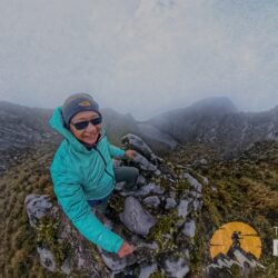
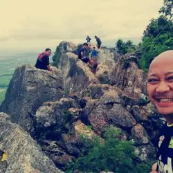


[…] This post was mentioned on Twitter by Remo Aguilar, Remo Aguilar. Remo Aguilar said: RT @hikersitch A tarsier, two waterfalls and the endless hike in Brgy Linan Tupi South Cotabato – .. http://bit.ly/9nFbLF […]
i agree to everything you say doc. especially the constructive criticism… that was the first tym that we xperience a post climb like that … we are all shock …. kahit kami rin poh nawala ng madaming beses kc pati yung naga lead d rin alam asan ang daan … we wasted sow much tym and energy and the fact that ang dami namin nakasabay sa trail na mga first tym mag trek super naawa kami talaga … we help them as much as we can at marami kami nasalubong na d na tumuloy sa falls … yung IT poh talaga nila parang d nagamit kc may mga last minute changes poh cila and wer not informed.. I hope poh ma improve poh yung pag host nila next tym and we all hope na nakatulong kami sa pagsave ng mga tarsier …coz honestly i was sow sad nung nakita kung nakatali ang tarsier …
@Mitchikoy, thought you enjoyed the trek since you where smiling all the time! (Joke!)But yeah, sinabi mo pa. I just hope they’ll look at this as a learning tool..
Thanks for dropping by my blog.
i had fun poh doc … coz every time my climb i gain new friends ( kahit d ko ma remember lahat ng names nila ) and learn something new ….
kc nga dba “the best climber in the world is the who’s having the most of fun” …. right ?
anyways doc i like reading your blog… great job poh i have much respect for your passion in doing this blog and also being a doctor at the same time a mountaineer …. God bless poh
the tarsiers have been there for as far as the Bl’aans can remember. they call the tarsiers tukaymal or “small monkey”. we recently talked to the elders and brgy officials on how to make the tarsier tourism sustainable and at the same time protect the tarsiers.
@Lantaw, you’re probably right. It’s pretty unusual for such tarsier community to just pop up this year even if the locals I talked to claimed it to be such. My guess is that some locals don’t have the information too or that they don’t want “outsiders” to really know whats “inside” to ward of potential “poachers” . I agree too that a serious conservation efforts should be done also…