

“Sometimes, it feels good to get lost in an adventure—or forget about time and schedules.” — Sir Joy
A Trail Begins: Letting Go of Control, Finding Flow
The Mt. Kalatungan-Wiji Traverse isn’t your average weekend hike. And from the start, we knew this climb would be more than a physical challenge—it was shaping up to be a photo climb, a therapeutic pause, and a test of presence.
We left Tacurong for Valencia City just before lunch, our car filled with gear and tentative excitement. I had planned an itinerary. Not strict, but solid. Still, with a group known for its laissez-faire attitude, I quickly realized that going with the flow would be the real guide.
Permits, Plans, and Pangantucan
By the time we arrived at Pangantucan’s tourism office, my anxiety about delays was already being replaced by awe. Engr. Rodel and Mr. Renato Sabado handled our permits like pros—triplicates signed by the mayor, orientation via Google Map topography —it was the most professional welcome I’d ever received on a trail.
Here’s the basic trail itinerary they gave us (and which I’d soon learn to hold loosely):
- Mendis Base Camp 1 – Last settlement with water
- Muleta/Buko sa Anay Ridge – Exposed ridge with zero water, scenic views
- Hunter’s Mini Hut – Temporary shelter with nearby water
- Sangaya-Muleta Fork – Trail split to Kalatungan or Lumpanag
- Mt. Kalatungan Peak – No water, stunning views
- Dwarf Bamboo Camp – Spacious, water available
- Lumpanag (Wiji) Peak – No water
- Dead Nails Trail – Brutal downhill
- Manobo Community – First post-forest human contact
Simple? Yes. Doable in two days? Questionable—especially for shutter-hikers like us.
Campfire Conversations and Cold Nights
That evening, we camped at Pangantucan’s town park, right next to the municipal hall. Our full group was finally assembled by 8PM. We ate, laughed, and bundled up for what turned out to be the coldest sleep I’d had in a while. Yet despite the chill, I slept well—a good omen for the trail ahead.
But morning brought sudden changes. Jo Sy had to head home due to a family emergency. Our original porters and guides, also facing medical issues, were replaced. We started the trek two hours behind schedule from Brgy. Mendis—without sunrise shots and a few lingering doubts in my gut.
From Mendis to Moss: Slow Steps, Rich Encounters
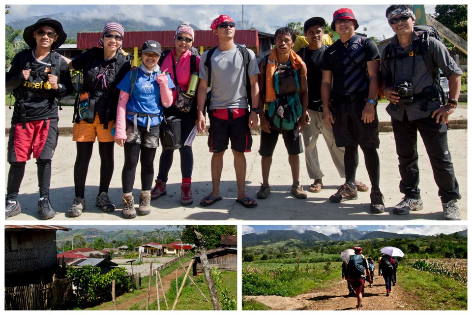
We began at 9AM, winding through grassy fields, small streams, and into Base Camp 1, where we met friendly locals and Manobo children. I felt humbled when a child asked for trail food I couldn’t provide. “A climber without trail food?” echoed in my mind.
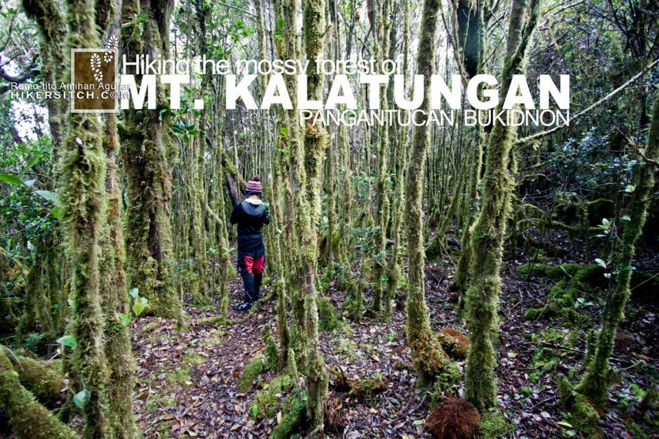
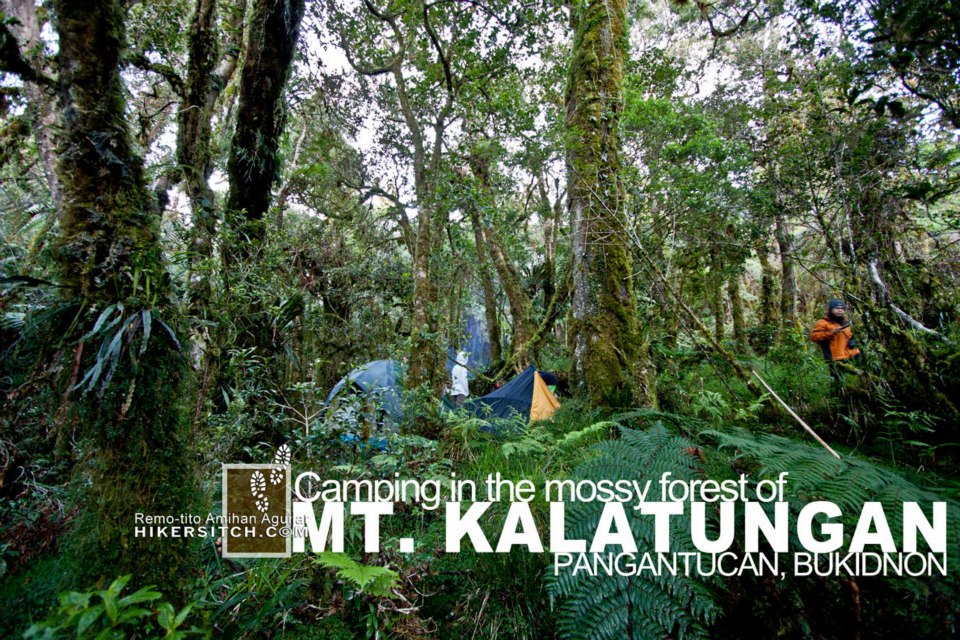
We reloaded water, captured panoramic shots, and then stepped into the first forest line around noon. Mt. Kalatungan’s forest is teeming with rare flora and fauna. As a photo climber, I paused for every unique leaf, mushroom, or insect that piqued my curiosity.
The mossy forest canopy was otherworldly. Time slowed. The act of walking became meditative. We stopped for lunch around 1:30PM inside this green sanctuary—exhausted, yet exhilarated.
Buko sa Anay Ridge: Spines, Snorts, and Shivers
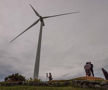
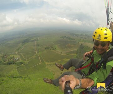
By 2PM, we began ascending Muleta Ridge, also known as Buko sa Anay or Pig’s Backbone. A kilometer-long open ridge exposed to wind and fog, it offered stunning views of Muleta Falls and Pangantucan’s sprawl.
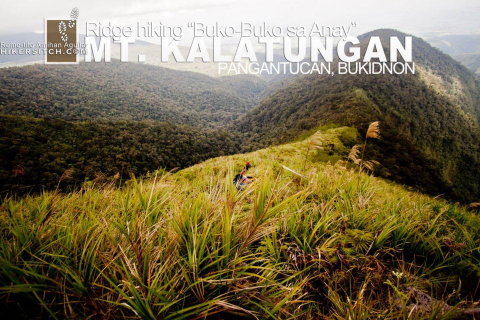
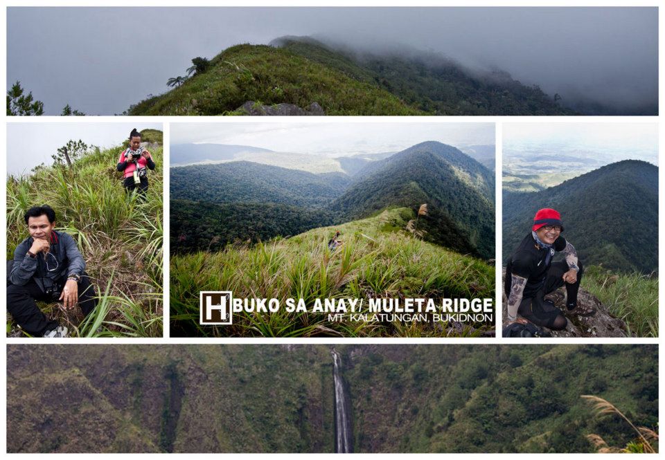
But as someone afraid of heights, I found little comfort on this dinosaur-like spine. I mumbled to myself, “What kind of photo climber fears cliffs?”
Fog descended. Winds picked up. Rain followed. I stuffed my camera into a makeshift raincoat—a garbage bag—and ran to the forest line. So much for slow shutter work today.
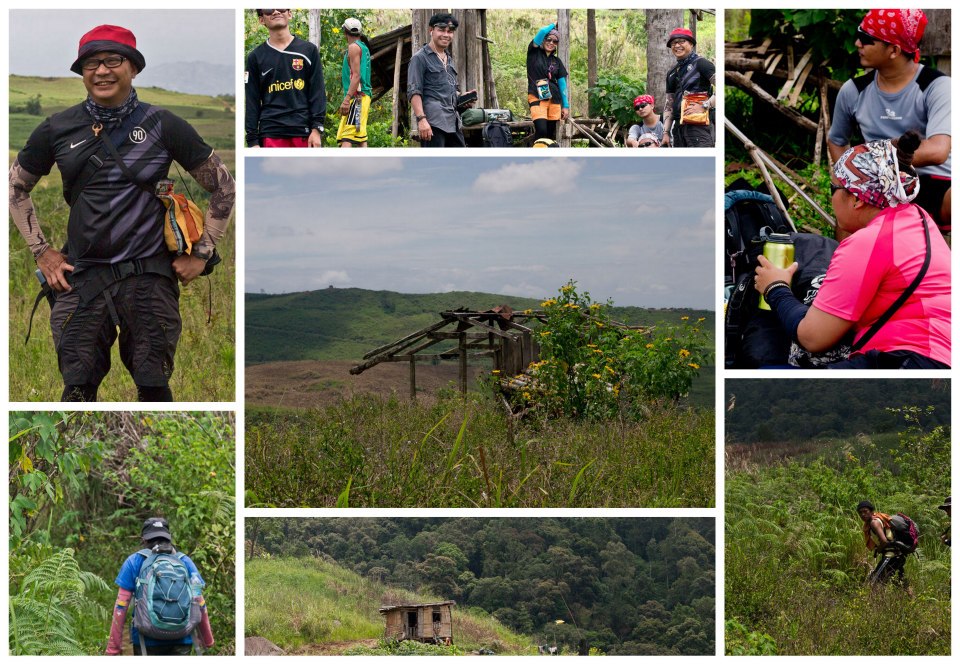
Shelter, Supper, and Sleep at the Trail Fork
We regrouped at a hunter’s hut. Wet, hungry, and freezing, we cooked dinner and tried to reset. The plan was to camp at the peak—but our delay made it too risky. Instead, we pitched tents at the Muleta-Kalatungan fork. It wasn’t the summit, but it was enough.
“Good night everyone,” I said, allegedly snoring within minutes. I don’t believe them.
Morning Light, Missed Sunrise, and a Shift in Perspective
We woke to clear skies—a reward for last night’s pivot. I’d hoped for a sunrise shot. But our valley camp was tucked between peaks. No sun until 10AM. “Frak,” I muttered. My photographer’s ego was bruised.
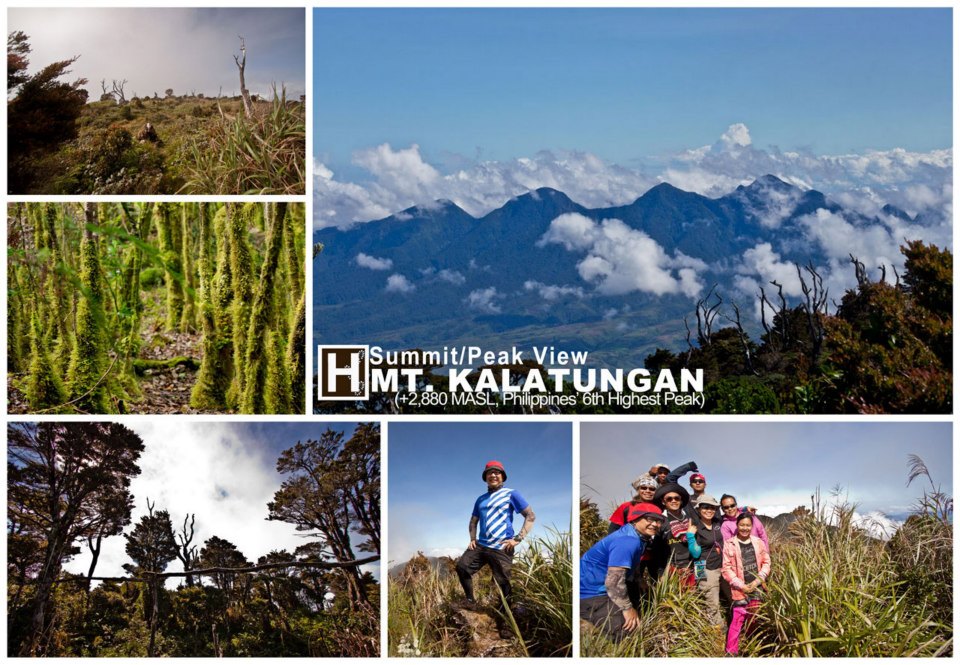
But what followed was better: by 8AM, we trekked 45 minutes to Mt. Kalatungan’s peak, arriving by 9AM under perfect skies. The summit offered a 360° view that stitched together every aching muscle and moment of doubt into something whole.
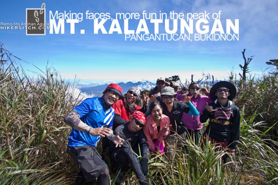
We weren’t “Kalatunga” (those who fail to summit). We made it. And it was glorious.
Next up in Part II: Traversing Kalatungan’s Ridge to Wiji—Chill winds, tea-colored waters, and the beauty of getting behind schedule.


The narrative made me feel like I’m with you guys during your climb. The view at the peak is really beautiful. Wish I could also climb Kalatungan someday. Great post Doc! Looking forward to the next part.
haha thats is the essence of this post! Let’s climb!
[…] A shutter-hike towards the peak of Mt. Kalatungan […]
[…] A shutter-hike towards the peak of Mt. Kalatungan […]
[…] A shutter-hike towards the peak of Mt. Kalatungan […]