A Photographer’s Field Guide to Mindanao’s Twin Peaks
Based on a 2013 Kalatungan–Lumpanag traverse via Brgy. Mendis, Pangantucan, Bukidnon. Trail conditions, regulations, access arrangements, guide requirements, and tourism policies may have changed since this expedition. Always verify current information with local authorities and guides before attempting the climb.
Why Mt. Kalatungan Still Matters
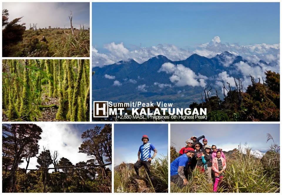
Standing at approximately 2,880 meters above sea level, Mt. Kalatungan is often overshadowed by its more famous neighbor, Mt. Apo. Yet among experienced Mindanao climbers, Kalatungan has long held a different reputation.
It is not merely high.
It is wild.
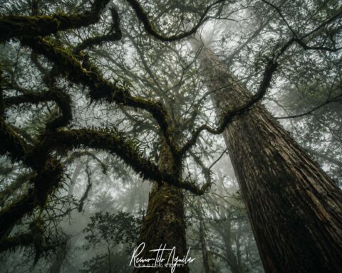
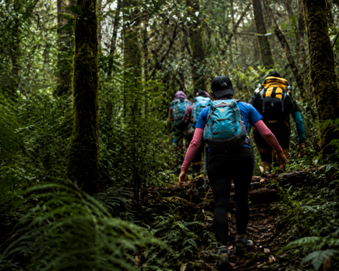
The mountain sits within the Mt. Kalatungan Range Natural Park in Bukidnon, one of the country’s most important remaining forest ecosystems. The traverse between Mt. Kalatungan and Mt. Lumpanag (also known locally as Wiji) passes through mossy forests, exposed ridges, dwarf bamboo zones, recovering secondary forests, and one of the more notorious descents in Philippine mountaineering—the Dead Nails Trail.
Our team originally approached the traverse as a “photo climb.” We wanted to experience the mountain slowly, carrying cameras alongside our hiking gear and allowing time to photograph landscapes, wildlife, forests, and people along the route.
What we discovered was that Kalatungan often has little regard for photographic plans.
The mountain rewards preparation, patience, and flexibility in equal measure.
Understanding the Traverse
For many hikers, Kalatungan is not a single summit but a journey through an entire mountain system.
The route we followed entered through Brgy. Mendis in Pangantucan and traversed:
- Mendis Jump-off
- Base Camp 1
- Muleta Ridge (Buko sa Anay)
- Sangaya-Muleta Junction
- Mt. Kalatungan Peak
- Dwarf Bamboo Camp
- Mt. Lumpanag (Wiji)
- Dead Nails Trail
- Manobo Community
- Exit Point
While technically possible as a fast traverse, photographers and slower-paced hikers may benefit from a longer itinerary that allows time for weather delays, exploration, and image-making.
One lesson from our expedition remains relevant today:
Mountains operate on mountain time. Photographers operate on photographer time. Combining both requires flexibility.
Planning the Climb
Physical Preparation
Kalatungan is not an ideal “fitness-building” hike.
Fitness should already be established before arrival.
The route involves:
- Sustained climbs
- Long descents
- Heavy packs
- Cold temperatures
- Frequent wet conditions
- Extended hours on uneven terrain
The section that surprised me most was not the ascent but the descent.
The Dead Nails Trail places significant demand on:
- quadriceps
- hamstrings
- calves
- stabilizing muscles around the knees and ankles
Many hikers prepare for elevation gain but underestimate the physical cost of several hours of steep downhill movement.
In hindsight, a training program emphasizing:
- hiking with load
- stair climbing
- downhill conditioning
- single-leg balance work
would have been more useful than focusing solely on aerobic fitness.
Team Composition
Kalatungan is not the place for loosely organized teams.
Assign responsibilities before departure.
Consider designating:
- Team leader
- Navigator
- Safety officer
- Communications lead
- Medical officer
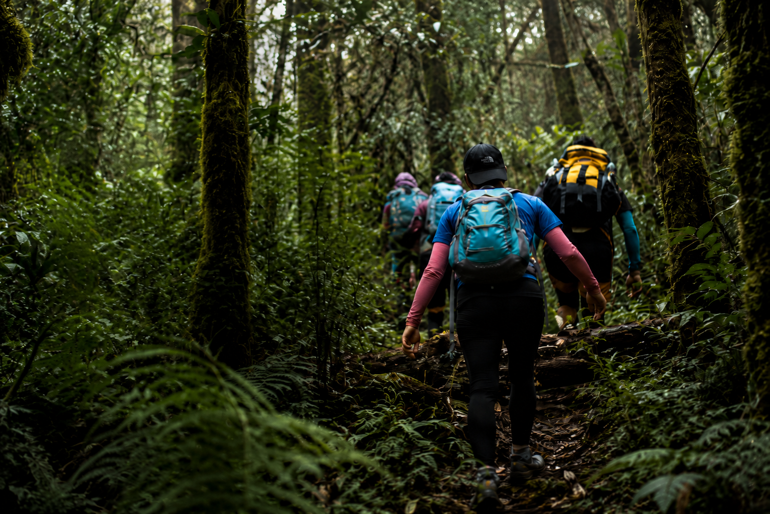
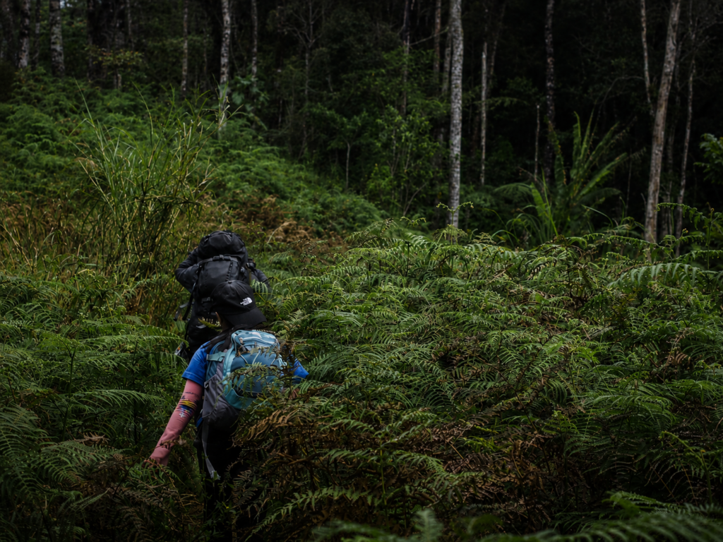
Photographers deserve special mention.
Photographers frequently stop, wander, linger, and separate themselves from the group while chasing compositions.
This behavior is often harmless in open landscapes.
In Kalatungan’s forests and fog, it can become dangerous.
Maintain visual contact whenever possible and establish clear regrouping protocols.
Local Coordination
One of the best decisions we made was coordinating closely with local tourism and community stakeholders.
Local guides provide:
- route knowledge
- weather awareness
- hazard identification
- cultural context
Treat guides and porters as integral members of the team rather than hired support.
Their experience often determines whether a climb feels stressful or seamless.
Navigation and Safety in 2026
When we completed this traverse in 2013, smartphone navigation was far less capable than it is today.
Modern hikers have access to:
- Offline GPS maps
- GPX route tracking
- Satellite imagery
- Emergency communication devices
Recommended navigation setup:
Primary
- Offline mapping app
- Downloaded maps
- GPX track if available
Secondary
- Dedicated GPS device or backup phone
Emergency
- Satellite communicator if budget permits
Technology should supplement—not replace—local knowledge.
Fog, weather, battery failure, and human error remain realities in the mountains.
Photography Strategy
The Biggest Mistake Most Photo Climbers Make
Bringing too much equipment.
Kalatungan is a mountain first and a photography location second.
The route rewards mobility.
The less time spent digging through gear, the more likely you are to notice changing light, weather, and wildlife.

If I were climbing Kalatungan today, my kit would likely consist of:
- Mirrorless camera body
- Wide-angle lens
- Short telephoto lens
- Lightweight tripod
- Spare batteries
- Waterproof protection
Many hikers today can create excellent images using a modern smartphone paired with a lightweight tripod.
The mountain cares very little about sensor size.
Weather Protection
Weather on Kalatungan changes rapidly.
During our climb we experienced:
- Bright skies
- Dense fog
- Wind
- Drizzle
- Continuous rain
often within the same day.
Protect gear using:
- Dry bags
- Rain covers
- Waterproof pack liners
A simple garbage bag saved my equipment more than once.
Technology evolves.
Weather does not.
Route Highlights for Photographers
Mendis to Base Camp
The lower sections provide opportunities for:
- Rural landscapes
- Agricultural scenes
- Local communities
- Trail portraits
These images often become more meaningful over time than summit photographs.
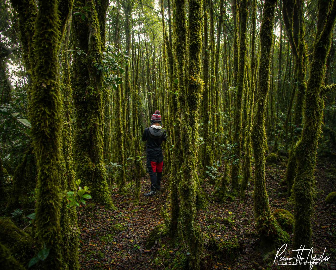
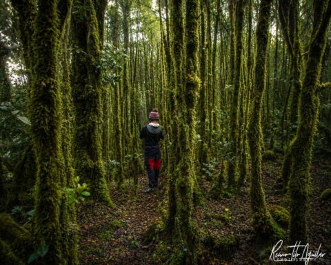
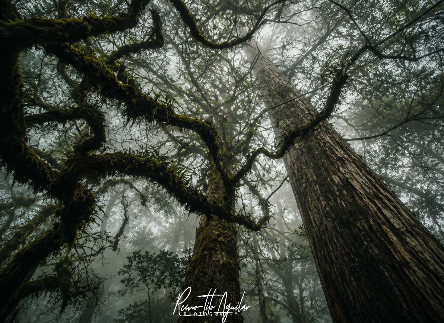
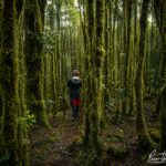
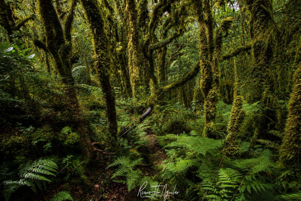
Mossy Forest
The mossy forests were among my favorite sections.
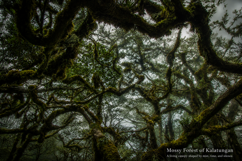
Look for:
- Moss-covered trees
- Fungi
- Insects
- Epiphytes
- Atmospheric forest scenes
Cloudy conditions often produce the best photographs.
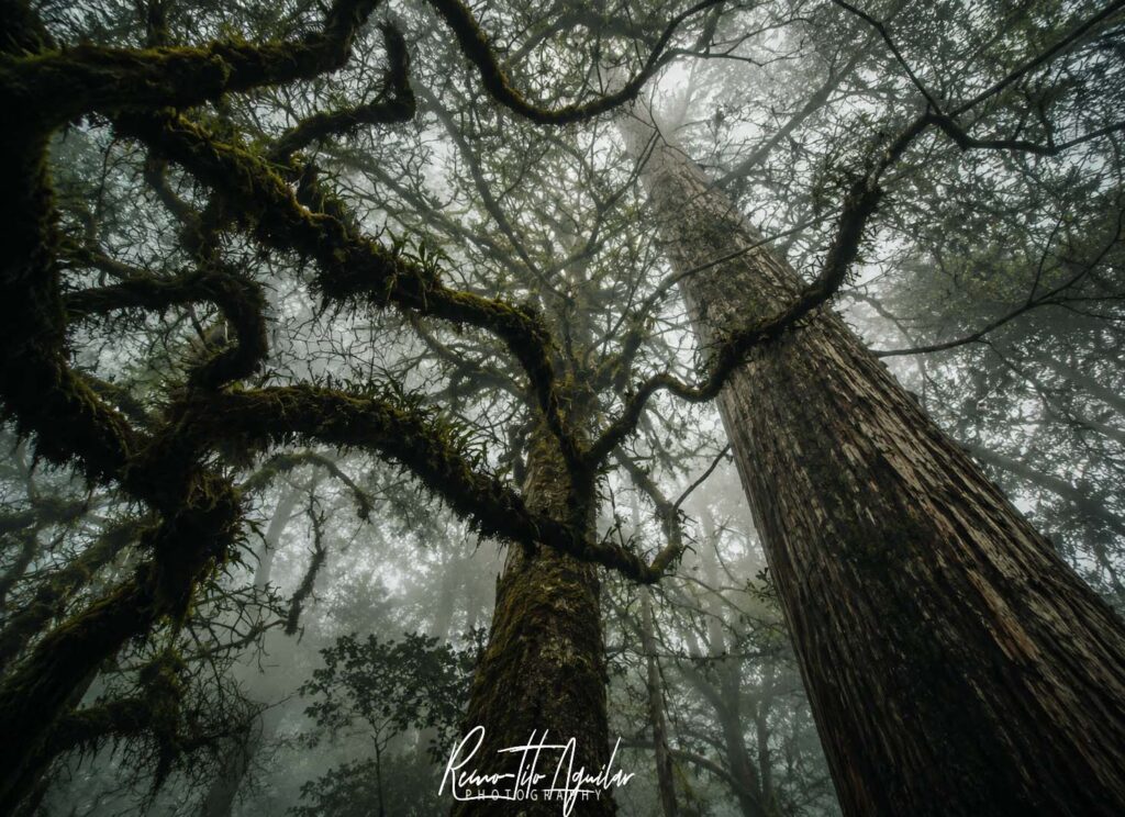
The forest feels timeless.
Take time here.
Muleta Ridge (Buko sa Anay)
This exposed ridge may be one of the most photogenic sections of the traverse.
On clear days it offers:
- Panoramic landscapes
- Valley views
- Weather formations
- Human scale against large terrain
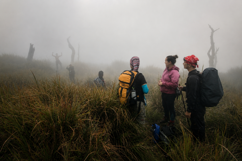
On our climb, however, weather changed quickly.
Fog transformed the ridge from a scenic viewpoint into a narrow corridor suspended between visibility and uncertainty.
Both experiences produce compelling photographs.
Mt. Kalatungan Summit
Under favorable conditions, the summit offers expansive views across Bukidnon and surrounding mountain ranges.
We arrived under clear skies after abandoning expectations for a sunrise shoot.
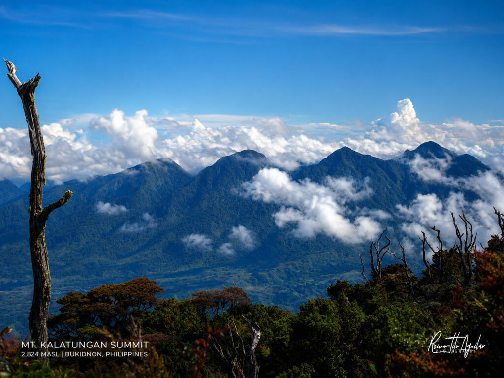
Ironically, the images we captured were better than the ones we had originally planned.
Dwarf Bamboo Camp
This area provides a unique transition zone with interesting textures and vegetation.
The nearby water source is valuable both photographically and practically.
Mt. Lumpanag (Wiji)
Our experience at Wiji contrasted sharply with Kalatungan.
Where Kalatungan welcomed us with views, Wiji greeted us with fog.
Visibility dropped dramatically.
The summit became less about landscape photography and more about atmosphere.
Sometimes the absence of a view becomes the story.
Dead Nails Trail
This is not where most people expect to make photographs.
Yet some of my strongest memories emerged here.
Fog, rain, narrow ledges, mossy forests, fatigue, and human perseverance create opportunities for powerful documentary-style images.
Just remember:
No photograph is worth compromising safety.
Water Sources and Camps
Water availability can influence route planning.
Historically, key water sources existed near:
- Base Camp areas
- Hunter shelters
- Dwarf Bamboo Camp
Conditions can change seasonally.
Always verify current information locally.
Carry sufficient storage capacity and a water treatment strategy.
Today, lightweight filters are often preferable to carrying excessive water weight.
Weather and Seasonal Considerations
Expect:
- Cold temperatures
- Rapid weather changes
- Heavy rain
- Dense fog
Even experienced hikers may underestimate how cold prolonged exposure can feel when wet.
Pack accordingly.
The best weather forecasts remain imperfect in mountainous terrain.
Always prepare for conditions worse than predicted.
Lessons From the Traverse
Looking back, the most valuable lessons were not technical.
They were behavioral.
Be Flexible
Every major delay in our climb eventually led to a better decision.
Respect Local Knowledge
Guides repeatedly identified risks we would have overlooked.
Stay Together
In dense forest and fog, separation happens faster than most hikers realize.
Carry Less
A lighter pack improves both hiking and photography.
Prioritize Safety Over Objectives
Summits, photographs, and schedules matter.
Getting home matters more.
If I Were to Climb Kalatungan Again
I would probably spend more time there.
Our original itinerary often felt rushed because we were trying to balance mountaineering and photography within a limited schedule.
Given another opportunity, I would choose:
- A longer itinerary
- More time in the mossy forest
- Additional nights near key photography locations
- Greater flexibility for weather
The mountain deserves patience.
Many of the photographs I remember were not carefully planned compositions.
They were moments that appeared unexpectedly between destinations.
Final Thoughts
Mt. Kalatungan–Lumpanag remains one of the most memorable mountain traverses I have experienced in Mindanao.
Not because it was the highest.
Not because it was the most technically difficult.
But because it demanded adaptability.
As photographers, we arrived with shot lists, schedules, and expectations.
The mountain gradually dismantled all three.
In exchange, it offered something better: a deeper experience of place.
For hikers, Kalatungan is a demanding traverse.
For photographers, it is a lesson in patience.
For those willing to embrace both, it remains one of Mindanao’s most rewarding mountain journeys.